File:Usgs map stereographic.PNG
From Vigyanwiki
Size of this preview: 799 × 286 pixels. Other resolutions: 320 × 115 pixels | 640 × 229 pixels | 1,024 × 367 pixels | 2,704 × 968 pixels.
Original file (2,704 × 968 pixels, file size: 389 KB, MIME type: image/png)

|
This map image could be re-created using vector graphics as an SVG file. This has several advantages; see Commons:Media for cleanup for more information. If an SVG form of this image is available, please upload it and afterwards replace this template with
{{vector version available|new image name}}.
It is recommended to name the SVG file “Usgs map stereographic.svg”—then the template Vector version available (or Vva) does not need the new image name parameter. |
Summary
| Description |
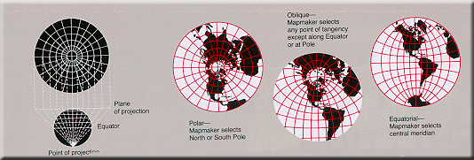
English: Stereographic map projection |
|||
| Date | ||||
| Source | Map projections | |||
| Author | U.S. Geological Survey | |||
| Permission (Reusing this file) |
|
File history
Click on a date/time to view the file as it appeared at that time.
| Date/Time | Thumbnail | Dimensions | User | Comment | |
|---|---|---|---|---|---|
| current | 07:15, 5 February 2025 | 2,704 × 968 (389 KB) | wikimediacommons>Mikhail Ryazanov | higher resolution |
File usage
There are no pages that use this file.